
Local Nature Reserves and Wildlife Sites
Local Nature Reserves
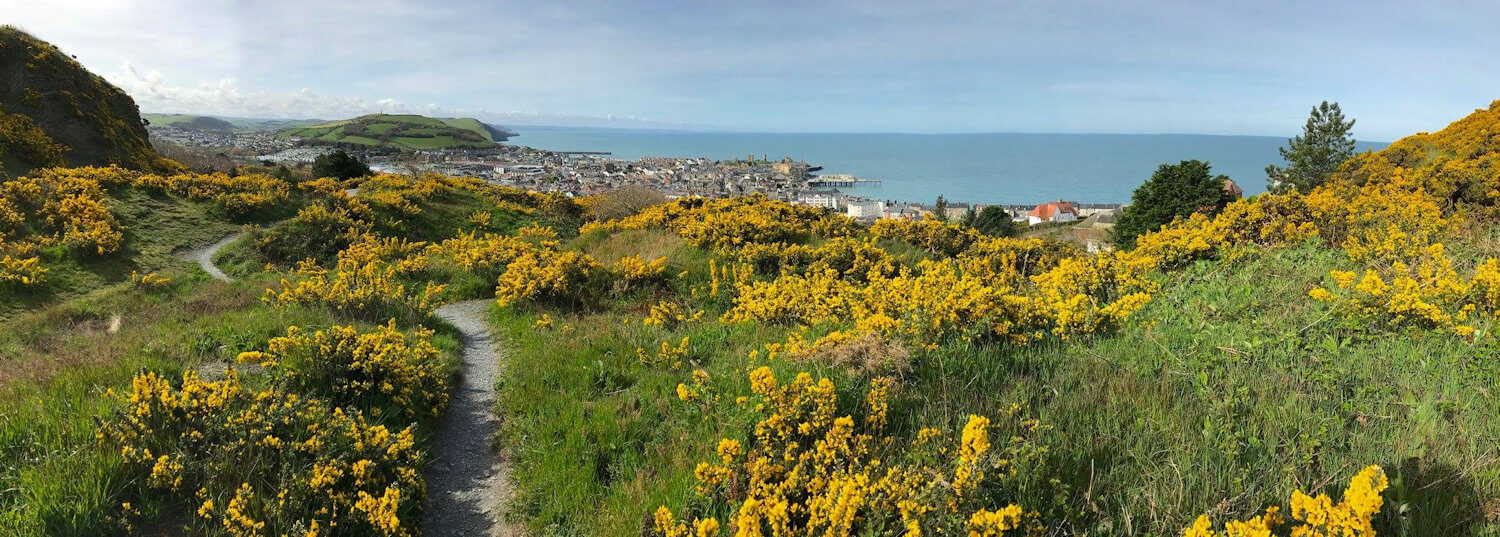
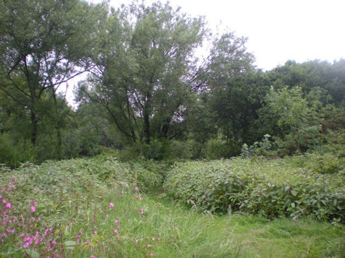
Parc Natur Penglais
| Key | Information |
|---|---|
| Nature Reserve | Parc Natur Penglais |
| Declared | 1995 |
| Size | 27 acres |
| Description | The only UNESCO Man and Biosphere urban reserve in Wales |
| Owner | Ceredigion County Council |
| Managed by | Ceredigion County Council |
| Grid Reference | SN591821 |
| What3Words | learns fairly masterpiece |
Parc Natur Penglais was established in 1991 and designated as a local nature reserve by Ceredigion County Council in 1995. The original Parc comprised part of the woodland of the former Penglais estate and the remains of a long-gone quarry with vegetated waste heaps of quarried spoil.
In 2015 the Parc was extended to the north to include a strip of bracken-covered hillside linking to another smaller deciduous wood beside Bryn y mor Road, bring the total area to some twelve hectares.
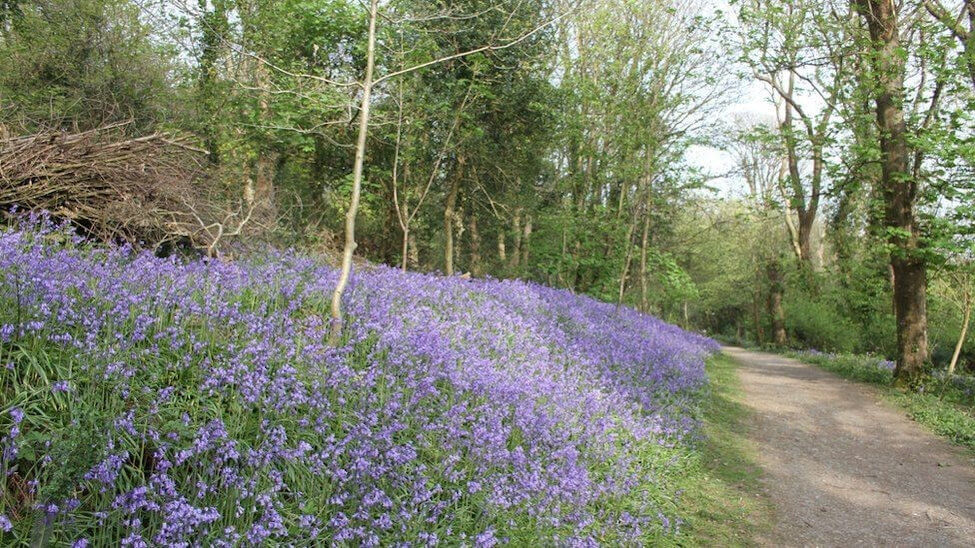
The broadleaved woodland of the original Parc has a spectacular display of bluebells in spring, while the old quarry and the new path give fantastic views over the town and the wider vista of much of the Ceredigion coastline.
A Support Group of local residents and Council representatives was set up when the Parc was established with the remit to advise the Council on the difficult task of balancing full access by the public for relaxation and enjoyment with the needs of wildlife conservation in an urban setting.
Over the years the Support Group has organised workdays for volunteers to help in the many tasks of maintaining and improving the reserve. The participation of generations of students from the Aberystwyth University Conservation Volunteers in these activities has played an important part in the care for the reserve.
The Support Group have been successful in securing many grants from different sources for improvements, with considerable sums being spent on upgrading a basic path network linking the main entrances, so that most visitors will follow these routes and be less inclined to disturb the wildlife in the wider reserve.
The popularity of the Parc by walkers is confirmed by the hidden counters mounted close to three of the many entrances that regularly record some 80,000 registrations each year.
The steep hillside terrain of much of the site means that access for the less-abled is not easy. However, a permissive path through university land behind Plas Penglais forms a more level route for those wishing to enjoy the bluebell display in the main wood.
- Penglais Guided Walk
- Penglais Management Plan
- Aberystwyth - Two Wood Walk
- Support Group
- Government Countryside Code: advice for countryside visitors
- Public and Community Transport
- Wildlife Recording - LERC Wales App
- West Wales Biodiversity Information Centre
Local Nature Reserves and Wildlife Sites
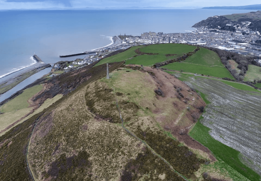
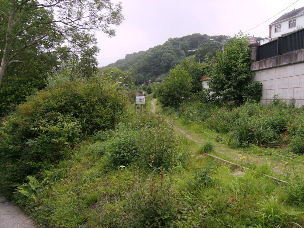
Pen Dinas and Tanybwlch Local Nature Reserve
| Key | Information |
|---|---|
| Nature Reserve | Pen Dinas and Tanybwlch Local Nature Reserve |
| Declared | 1999 |
| Size | 26.49 acres |
| Point of Interest | Iron Age hill fort |
| Owner | Ceredigion County Council |
| Managed by | Ceredigion County Council |
| Grid Reference | SN584802 |
| What3Words | rags.angle.fists |
A reserve with something to interest everybody, it consists of an Iron Age Hill-Fort, hay meadow, river, beach, vegetated shingle spit, an old railway track and even a disused landfill site!
The Iron Age hill fort of Pen Dinas, dating from 300 BC to 43 AD, is at the heart of this site. The hill fort and its surrounding habitats form the County's second Local Nature Reserve.
The site is accessible from Aberystwyth by several footpaths and there is a car park at the stone jetty. The Ystwyth Trail passes through the site.
- Royal Commission on the Ancient and Historical Monuments of Wales
- Pen Dinas and Tanybwlch Walk
- Aberystwyth, Pen Dinas and Rheidol Circular Walk
- Government Countryside Code: advice for countryside visitors
- Public and Community Transport
- Wildlife Recording - LERC Wales App
- West Wales Biodiversity Information Centre
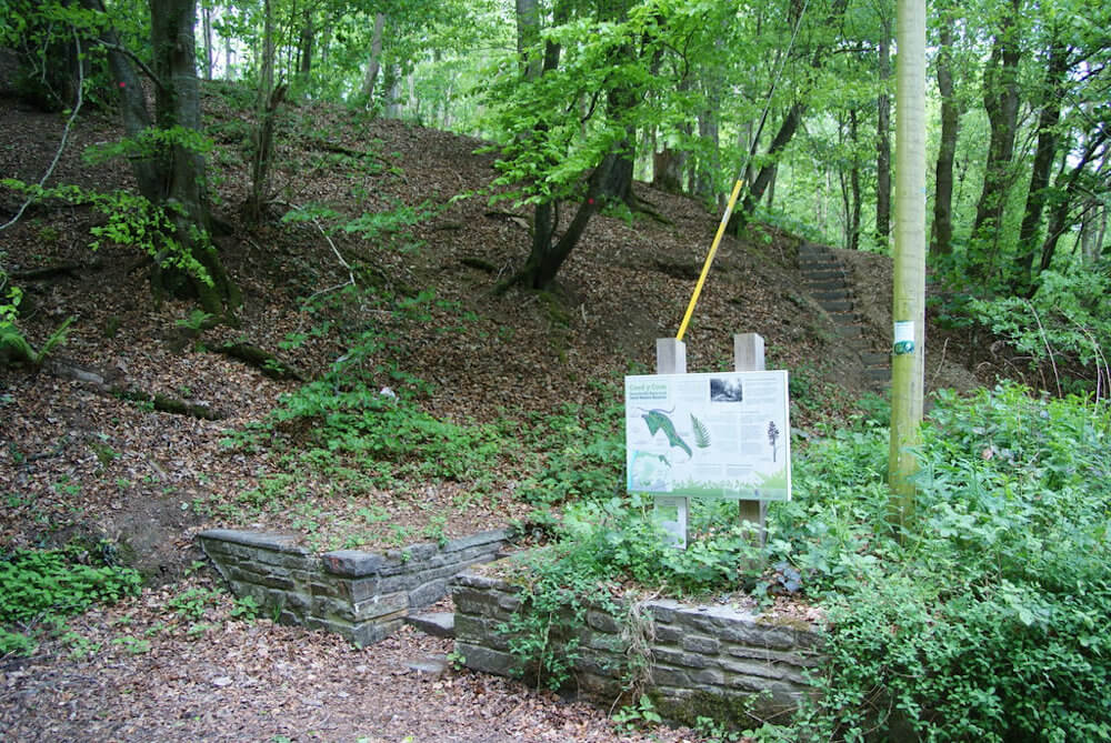
Coed y Cwm Local Nature Reserve
| Key | Information |
|---|---|
| Nature Reserve | Coed y Cwm Local Nature Reserve |
| Declared | 2010 |
| Size | 23.4 acres |
| Description | Ancient semi-natural woodland |
| Owner | Ceredigion County Council |
| Managed by | Ceredigion County Council |
| Grid Reference | SN599834 |
| What3Words | tenders.sobs.fruitcake |
This is an ancient semi-natural woodland site that once formed part of the old Plas Cynfelin estate. It was bought by the then District Council in 1948 from the Minister of Supply for the princely sum of £3000.
The site was designated a Local Nature Reserve in 2010. The woodland has a range of nooks and crannies where a wide variety of species flourish. In particular, the old quarry area last worked in the 1950's provides many different micro habitats with its rocky cliffs and sheltered hollows.
Wildlife Sites
Council Owned Wildlife Sites - insert doc
Aberystwyth Area
Cwm Woods


Large deciduous broadleaved woodland on hillside overlooking the Clarach valley. Woodland trails and footpath links to Aberystwyth and Clarach.
| Size | Grid Reference | What Three Words |
|---|---|---|
| 9.47 ha (23.40 acres) | SN601832 | starters.toothpick.footsteps |
Coed Geufron, Penparcau
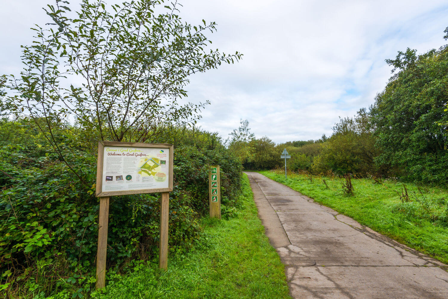
Visit Coed Geufron - Woodland Trust
Wet woodland, grassland and shingle banks provides cover for many species to flourish including otters and outstanding invertebrate interest resulting in it becoming a Site of Special Scientific Interest.
You can walk in the wood or in the open grassland and admire the trees, plants and fungi that thrive in the area. The site provides an accessible woodland and open space within walking distance of Aberystwyth.
The Management Plan is available to view from the Woodland Trust website.
| Size | Grid Reference | What3Words |
|---|---|---|
| 9.79 ha (24.19 acres) | SN601801 | serves.friends.devoured |
Llwyn yr Eos, Penparcau
Behind the school in Penparcau, this tiny woodland is primarily for the benefit of local residents and the children of the After School club who are learning various Forest activities, but if you're in the area anyway, why not take a look. Information panel at entrance.
| Size | Grid Reference | What3Words |
|---|---|---|
| Tiny | SN594799 | tagging.sapping.ignore |
Parc y Llyn
Riverside walk through old farm meadows adjacent to the cycle route near Morrisons.
| Size | Grid Reference | What3Words |
|---|---|---|
| Tiny | SN594799 | clerics.shadowing.noises |
Aberaeron and New Quay Area
Llanina Woods, New Quay


Particularly suitable for the less able, with its path winding its way through mixed broadleaved and young ash woodland alongside the river. Managed in conjunction with Welsh Water. Public paths near the site lead to Llanina Church and Llanina Point. Information panel and car park.
| Size | Grid Reference | What3Words |
|---|---|---|
| 50 Acres | Sn404592 | live.recording.derailed |
Maes y Pwll Community Woodland, New Quay
Maes y Pwll was the name of the property that once stood on this site and now its large wooded garden on the coastal slope above the beach at New Quay has been turned into an area for all the people of this popular seaside town and its visitors to enjoy. Managed in conjunction with New Quay Town Council. Information panel at entrance.
| Size | Grid Reference | What3Words |
|---|---|---|
| SN390590 | cheaper.tadpoles.sometimes |
Cardigan Bay Lookout, Birds Rock, New Quay
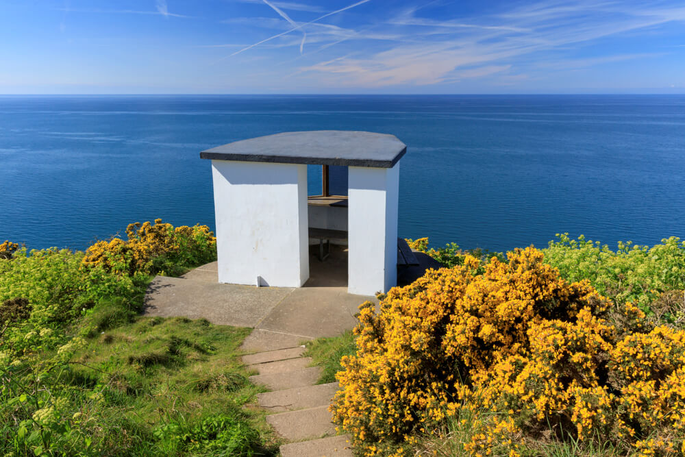
Former Coastguard lookout with breathtaking views of Cardigan Bay and its wildlife. The Lookout was restored in 2001 with assistance from the Crown Estates Marine Stewardship Fund.
| Grid Reference | What3Words |
|---|---|
| SN376600 | eruptions.dolly.walking |
Teifi Valley
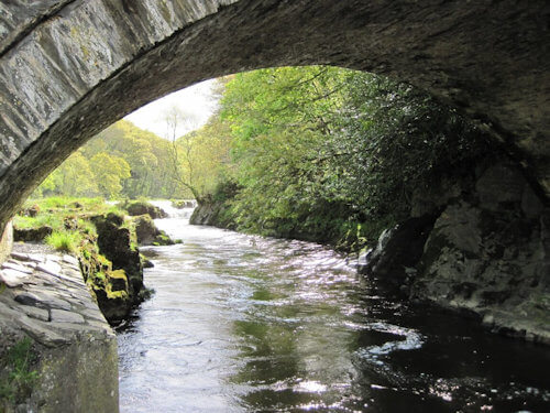
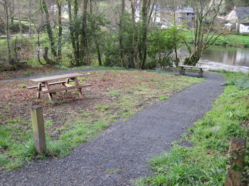
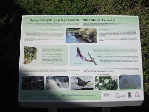
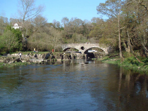
Cenarth Riverside
Tiny, but lovely riverside site adjacent to Cenarth's ancient bridge and Falls.
| Grid Reference | What3Words |
|---|---|
| Ask for help with grid ref. |